Box 1 – Modern and Relict Permafrost in the Aquifers of the West Siberian Basin
The West Siberian Basin forms a huge mega aquifer system, 3.2 million km2 in extent and filled with Triassic to Quaternary deposits, reaching a maximum of approximately 6 km unfrozen thickness.
Modern discontinuous permafrost covers the northern one-third of the basin (north of approximately 61°N), while relict Late Pleistocene permafrost buried to depths ranging from 50 to 400 m is reported to occur as far south as 55°N, encompassing more than three-quarters of the basin. The area occupied by the relict Late Pleistocene permafrost includes three distinct zones (Figure Box 1-1). In the northernmost zone, both types of permafrost (modern and relict) form a more or less monolithic structure. The mid-zone, south of the Arctic Circle (66.5°N), is primarily a two-layered structure with a thawed layer between the surficial frozen layer and the relict Pleistocene frozen layer below. In the southernmost third zone, only relict permafrost is present, with its top between 150 and 230 m deep, and its base down to 400 to 500 m in depth (Foley et al., 1994).
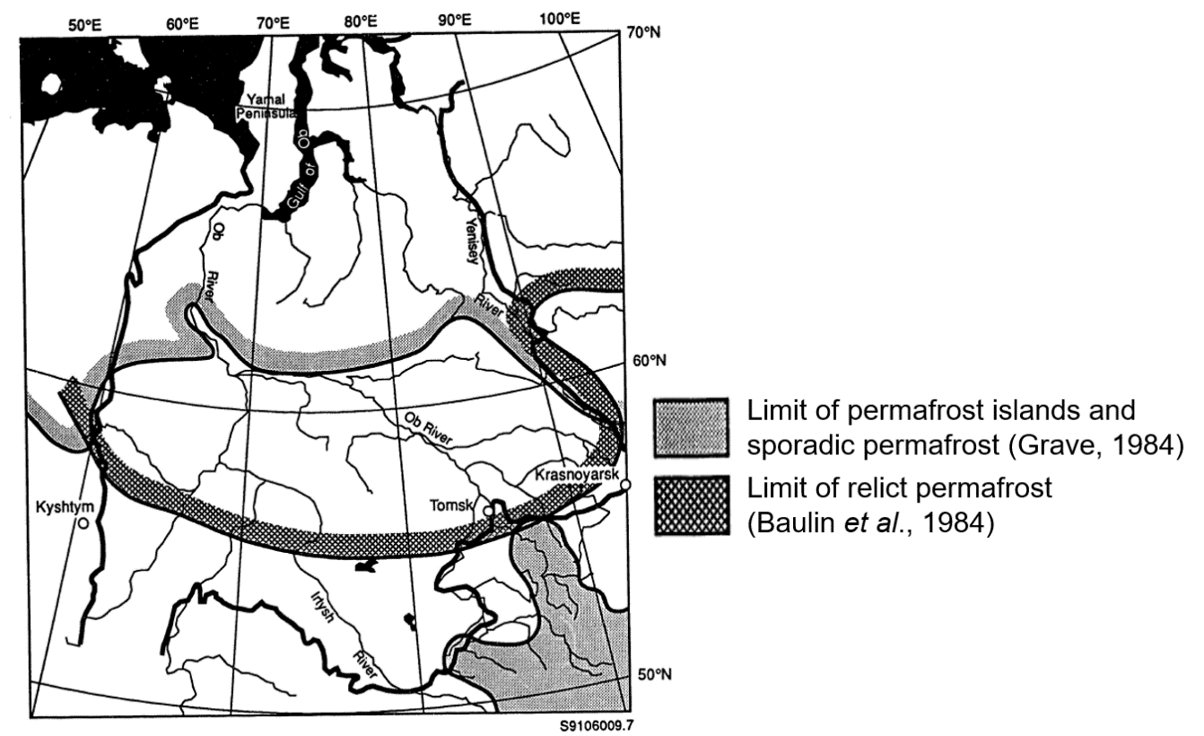
Figure Box 1–1 – Permafrost limits (Foley et al., 1994).
The West Siberian region was affected by rapid permafrost degradation and peatland expansion during the Early Holocene; the region’s response to current anthropogenic warming is expected to be rather similar (Li et al, 2021; Teshebaeva et al. 2021). Frey et al (2007) concluded that the rapid warming and degradation of permafrost will increase the transport of dissolved solids to the Kara Sea and the adjacent Arctic Ocean, which may cause problems for future biological productivity in the waters from the arctic shelf of Eurasia and the interior of the Arctic Ocean Basin.