7.2 Recharge Area
Diamond and Harris (2000) made a study of the hot springs (Figure 34) in Western Cape, South Africa, including collection of precipitation near springs. They found the stable isotope values of the springs to be significantly more negative than the rain falling on the ground near each spring (Figure 35). Isotope exchange with rocks was ruled out due to the relatively low temperature of the spring water (the maximum being 64 °C), thus a deep, long flow path through the fractured quartzites of the Table Mountain Group was postulated. The flow paths for each spring included recharge at high altitude (up to 2000 m), which could explain the relatively negative isotope compositions, caused by the altitude effect. The postulated high elevation of recharge was consistent with a high head required to drive a long flow path with deep circulation that could heat meteoric water to the spring water temperatures. The existence of long groundwater flow paths is important for protecting recharge areas because any impact on the water source may not be observed at the discharge location until many years later.
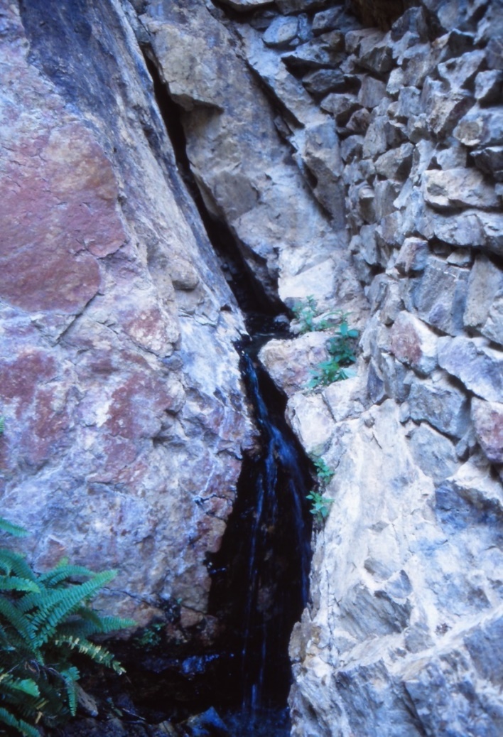
Figure 34 – The Citrusdal hot spring (43 °C) in the Cape Fold Belt of South Africa. Groundwater flows through the Cape Supergroup in fractures and in some cases circulates deeply enough for water to be heated. This photograph shows one of the discharge points of the spring – several other fractures within a few meters of this point also discharge hot water.
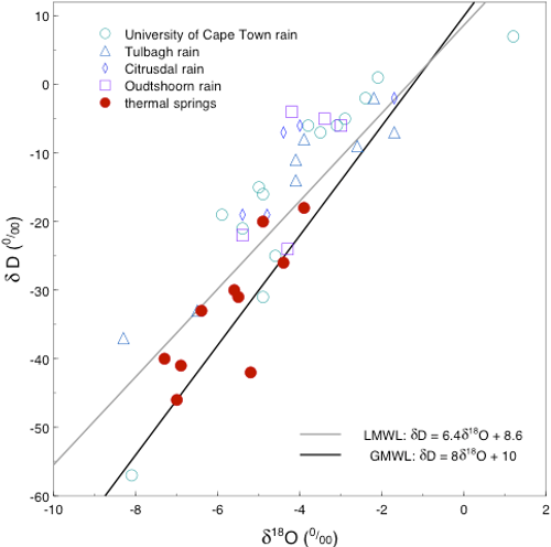
Figure 35 – Stable isotope compositions of cumulative monthly precipitation samples from 4 precipitation stations and single samples or averages of monthly samples from the thermal springs of the Cape Fold Belt in South Africa. The tendency of the spring water to have lighter isotopic composition suggests recharge at higher altitude, made possible by deep groundwater circulation through large fold structures, which have wavelengths of many kilometers. Data from Diamond and Harris (2000), LMWL from Harris and others (2010) and GMWL from Craig (1961).