4 Availability of Well Record Databases
Given that the requirement for well contractors to submit well construction reports has been standard practice in many countries now for decades, and about 45 percent of the world’s population resides in rural areas (United Nations, 2019) where domestic wells are the preferred water supply source, it is estimated that there could be up to 100-million water well records archived worldwide. Access to water well records, however, is highly variable, ranging from hard copy reports that were filed or scanned, to digital data that can be readily shared over the internet. About 39 million digital, water well records were compiled from 40 countries or territories in a global study of the sensitivity of groundwater wells to water level declines over the period of 1950 to 2015 (Figure 4; Jasechko and Perrone, 2021). In some countries, national level well record datasets are available (Table 2) while in other countries the data is published by subnational governments.
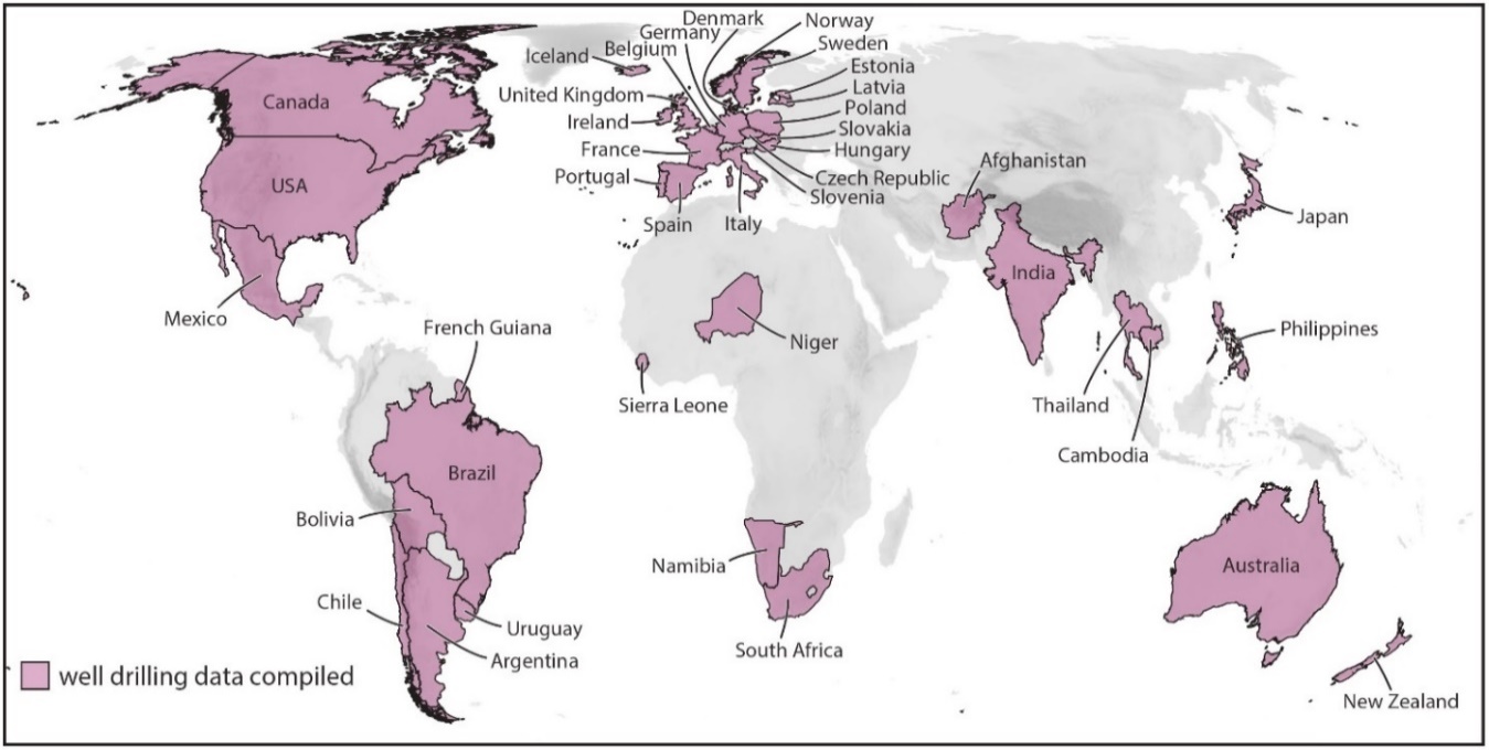
Figure 4 – Compiled water well records for a study of the sensitivity of groundwater wells to water level declines from 1950 to 2015. Only partial data coverages were available for the United States, Argentina, Bolivia and Germany (after Jasechko and Perrone, 2021).
Table 2 – Selected water well databases that provide publicly available, digital, harmonized (i.e., disparate file formats brought into one cohesive data set) or country-scale views of water well data.
| Country | Data Source |
| Tanzania, Malawi, Mozambique, Zimbabwe, Botswana, South Africa, Lesotho, Swaziland, Namibia, Madagascar | Southern African Development Community (SADC) Groundwater Information Portal |
| Australia | National Groundwater Information System |
| Brazil | SIAGAS Groundwater Information System |
| Cambodia | The Online Well Database of Cambodia |
| Canada | Groundwater Information Network (GIN) |
| Denmark | National Well Database (JUPITER) |
| Germany | Borehole Map of Germany |
| Norway | National Groundwater Database (GRANADA) |
| Spain | Institute of Mining and Geology of Spain – Water Points Database |
| United Kingdom | GeoIndex Onshore – Water Wells |
| Uruguay | Mining Geological Viewer – Well Data |
Over the past several decades, many jurisdictions around the world have moved to an open data, internet distribution model for well record databases, where well record data is freely available and offered for download in multiple formats (e.g., database, text, web map service, EsriTM shapefile/geodatabase, Google EarthTM data files). Although the availability of online well record information is growing quickly, privacy concerns in some jurisdictions continue to restrict opportunities for open sharing of this information.
The inter-operability of these datasets, however, is limited, which can be an important consideration for the overall hydrogeological assessment of a management area, especially one that crosses political borders. Challenges with respect to the discovery of, and access to, harmonized datasets are largely related to the distributed custodianship (e.g., subnational) and heterogeneity of well record information (Brodaric et al., 2018). Approaches to resolve these challenges include standardizing the terminology of hydrogeologic data recorded on well logs at a national level (e.g., Australia’s National Aquifer Framework) or the translation of well record data from different data providers into a common language (e.g., Borehole Map of Germany or Canada’s Groundwater Information Network). More information about Canada’s approach to harmonizing data from various sources is provided in Box 2. The Southern African Development Community (SADC) Groundwater Management Institute (GMI) commissioned the development of a Groundwater Information Portal—developed and maintained by the International Groundwater Resources Assessment Centre—for accessing harmonized groundwater information in southern African countries, including water well records (Figure 5).
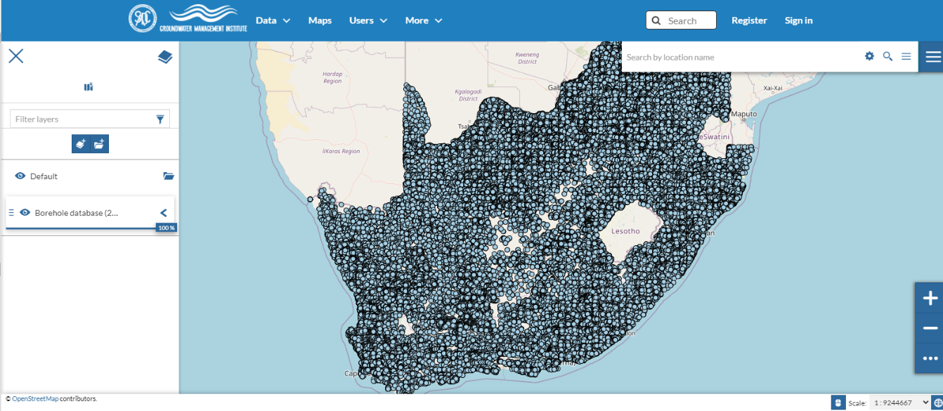
Figure 5 – Screenshot of the SADC Groundwater Information Portal showing the location of borehole records for various southern African countries.
These new models of data distribution have also permitted the development of new tools and widgets for the visualization and analysis of well record data, including the dynamic generation of graphic logs of well completion and stratigraphy information (Figure 6).

Figure 6 – Screenshot of the tool for visualizing well record stratigraphy information as part of Canada’s Geographic Information Network (GIN, 2020). Data for the selected record is from the Alberta Ministry of Environment and Parks, provided by GIN.