4.3 Flow-through Wetland
Flow-through wetlands occur when the water table is higher on one side of the wetland than the other side creating a gradient for water to enter and leave the wetland as illustrated by Figure 20 and Figure 36 by substituting the label wetland for stream and lake, respectively, and by Figure 46. Often these wetlands have no surface-water inlet or outlet. The wetland surface represents the elevation of the local water table.
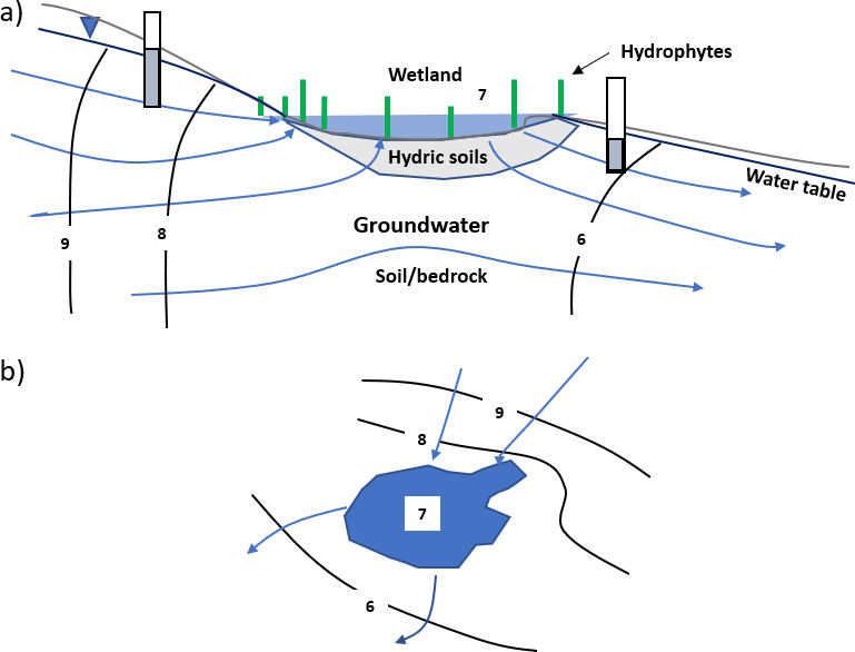
A flow-through wetland may also form a depression spring where the water table intersects the land surface. In a spring setting, water exits the wetland as surface flow, down-slope groundwater discharge and/or is lost by evapotranspiration.