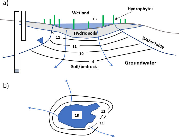
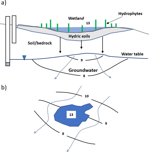
Influent or losing wetlands leak water downward into the underlying and adjacent groundwater system (Figure 44). In this setting the wetland surface represents the water table. An influent wetland also occurs when the zone of saturation is disconnected from the wetland and the wetland percolates water through the unsaturated zone (vadose zone) to the underlying groundwater system (Figure 45). The water surface elevation of the wetland does not represent the water table under perched conditions.
Figure 44 – Schematic cross section and map view of an influent wetland. Equipotential lines and relative head values are in black. Groundwater flow lines are in blue. Isotropic and homogeneous conditions are assumed. Monitoring wells are open at the bottom. The wetland stage represents the water table. a) Cross section of an influent or losing wetland that is connected to the water table. b) Map view of an influent wetland (Woessner, 2020).Figure 45 – Schematic cross section and map view of an influent wetland perched above the water table. Equipotential lines and relative head values are in black. Groundwater flow lines are in blue. Isotropic and homogeneous conditions are assumed. Monitoring wells are open at the bottom. The wetland stage does not represent the water table. a) Cross section of an influent or losing wetland that is perched above the water table. b) Map view of an influent wetland perched above the water table (Woessner, 2020).