Box 1 Gridding Sparse Data
With data from a sufficient number of boreholes, all gridding algorithms should reproduce the same geologic surface. With sparse data, the surfaces will diverge from one another. For the Test Site, gridding of the H01 surface using only the elevation data measured in the 14 boreholes is shown using a few different methods in Figure Box 1-1.
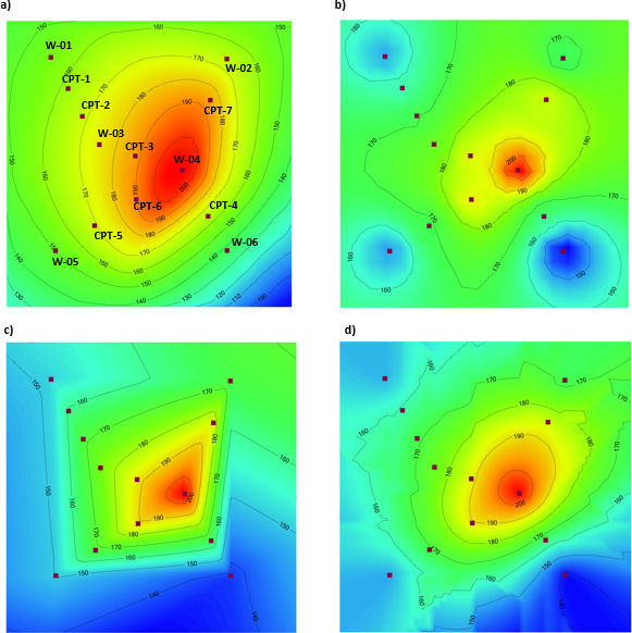
These images were created with the gridding algorithms available in Visual MODFLOW FLEX (Waterloo Hydrogeologic, 2020) using mainly default parameters. With experience, the gridding parameters can be adjusted to create a surface closer to what is expected for H01. This is particularly true for Kriging, which is designed for irregular geologic datasets. However, no matter the choice of algorithm, some prior concept of the geology is required.
Performance of gridding algorithms is always poorest near the periphery of the grid. The algorithms perform interpolation inside of the area delineated by the datapoints, and extrapolation outside. Extrapolation is inherently more uncertain, which can result in gridding artifacts when the boundary is far from the data points.