
13.2 Basics of Surface Water
When rain falls on the Earth, some of it soaks into the ground, some is taken up by plants and animals, and some evaporates into the air. The rest of the water—the part that drains to the nearest creek or river and flows towards the ocean—makes up the part of the hydrologic cycle that we call surface water.
A stream is the general term used to describe a body of flowing water on the Earth’s surface that is contained within a channel. Streams receive their water from a surrounding area called a drainage basin, watershed, or catchment. Watersheds are defined by the topography surrounding the stream, and watersheds are determined by arbitrarily selecting a point on a stream and delineating the area that drains to that point (Figure 99 and Figure 100).
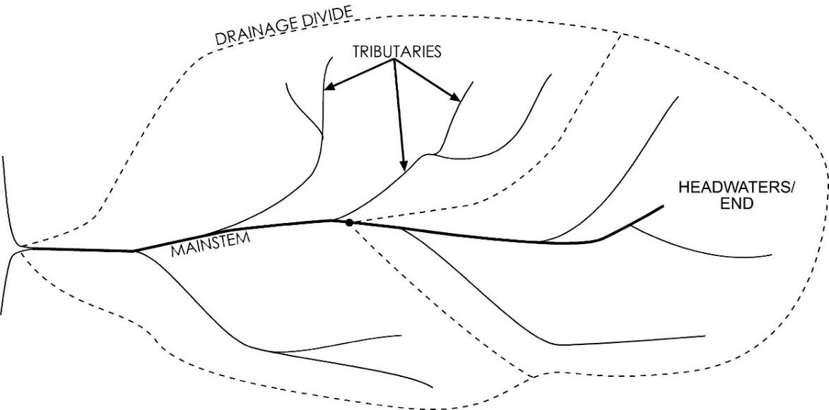
Figure 99 ‑ Schematic diagram of two watersheds delineated by dashed lines with the watershed on the right that includes the headwaters being a portion of the entire water shed.
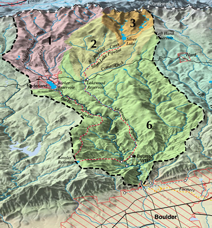
Figure 100 ‑ Shaded-relief image of a watershed (reproduced from https://bcn.boulder.co.us/basin/waterworks/watersheds.html↗).
Some definitions relevant to the discussion of surface water include the following.
- The topographic high that separates one watershed from the next is called a drainage divide—the black dashed line in Figure 100.
- The place where the stream starts flowing at the highest point in the watershed is called the headwaters or the end of the stream.
- The point where the stream finally flows into another body of water—a river, lake, reservoir, or the ocean—is called the mouth of the stream.
- The primary channel in the stream is called the mainstem; smaller streams that flow into the mainstem are called tributaries.