
16.1 Properties of Aquitards
Aquitards can be found at or near the surface (e.g., saturated, clay‑rich tills) and at depth (e.g., shale and mudstone units). When aquitards are extensive and overlay deeper confined aquifers, they are commonly referred to as confining units (Figure 139). In some settings these units contain zones of higher‑permeability materials and may be discontinuous.
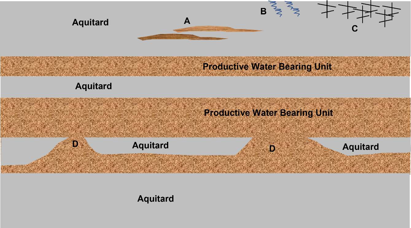
Figure 139 ‑ Schematic of a sequence of aquitards and productive water‑bearing units. Aquitards can be homogeneous, heterogeneous, contain macro pores, fractures, and erosional or depositional windows that limit the local extent of aquitards. The gray shading represents a uniform homogeneous aquitard. “A” represents a heterogeneous setting where lenses of material with differing permeability are present. “B” shows macropores created by roots near land surface. “C” shows fractures that can be near the surface or at depth depending on the geologic history of the region. “D” shows windows within an aquitard that allow movement of water between productive water‑bearing units.
Aquitards are often composed of non‑indurated silts and clays, mudstones, shales, or other low‑permeability rocks. Clay‑ and silt‑rich systems are typically unlithified and are deposited in lacustrine, glacial, or marine environments. Lithified aquitards include mudstones, shales, some well cemented sedimentary rocks including chemical precipitates, and fractured igneous and metamorphic rocks (Cherry et al., 2004). In some settings, secondary porosity and permeability are present, most often as macro‑pores or fractures in near‑surface deposits and fractures in deeper formations, features that usually enhance permeability.
Cherry and others (2006) and Bradbury and others (2006) provide good reviews of the role of aquitards in influencing the movement of groundwater and contaminants, as well as extensive discussions of aquitard types, depositional histories, and the post‑depositional processes affecting aquitards. The authors state that non‑indurated aquitards with 10 to 15 percent clay are classified as clayey aquitards that effectively limit flow and contaminant migration when they do not contain preferential flow paths such as root holes (near‑surface deposits with macro‑pores) or fractures. Hydraulic studies that measure vertical gradients within aquitards have shown that, in some cases, the conditions restricting groundwater flow are not uniform but occur over a limited vertical portion of the aquitard as shown in Figure 140 (e.g., Cherry et al., 2006; Meyer et al., 2008; Meyer et al., 2014; Meyer et al., 2016). Most characterization methods assume the distribution of hydraulic conductivity in an aquitard is isotropic and homogeneous, although most aquitards are heterogeneous.
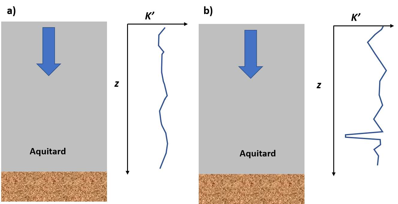
Figure 140 ‑ A schematic of the distribution of vertical hydraulic conductivity, K’, in two aquitards. The blue arrow represents water flowing downward. a) The K’ in this example is relatively uniform with depth, z. b) This aquitard has a zone about 75 percent of the distance from the top where a low K’ is indicated. This zone will control the rate of vertical movement in this system.